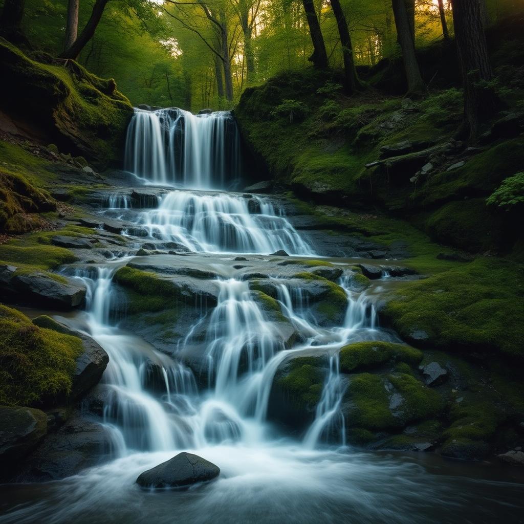
Shenandoah National Park alone counts more than a dozen named waterfalls, and the surrounding national forest and state parks add a half-dozen more. Spring (March–May) is peak flow; late summer and early fall are quieter but reduced to a trickle in dry years. Here are the waterfall hikes that consistently deliver — sorted by how much trail you have to commit to.
Easy (under 2 miles round-trip)
Dark Hollow Falls — 1.4 mi, 440 ft descent
The most-hiked waterfall trail in the park, and for good reason: a 70-ft cascade in less than a mile of walking. The catch is the climb back out, which is steep and unrelenting. Trailhead at Skyline Drive mile 50.7.
South River Falls Overlook — 0.6 mi
A short walk to a viewing platform looking down on the third-tallest waterfall in the park (83 ft). The full out-and-back to the base is 3.3 miles. Trailhead at Skyline Drive mile 62.8.
Crabtree Falls Lower Viewing Platform — 1 mi
Outside the park near Montebello, Crabtree is the tallest cascading waterfall east of the Mississippi at 1,200 ft of total drop. A 1-mile out-and-back gets you to the lower platform; 3 miles round-trip gets you to the top.
Moderate (2 – 5 miles)
Whiteoak Canyon (Upper Falls) — 4.6 mi, 1,000 ft descent
Six waterfalls in a single canyon. The upper falls (86 ft) are 2.3 miles in from the Skyline Drive trailhead at mile 42.6. Continue another 2 miles to chain together the lower cascades — but expect a hard climb back out.
Doyles River Falls — 3.2 mi
A pair of waterfalls — Upper (28 ft) and Lower (63 ft) — strung along a creek in the South District. Less crowded than Dark Hollow and arguably prettier. Trailhead at Skyline Drive mile 81.1.
Rose River Loop — 4 mi, 720 ft descent
A loop that strings Rose River Falls and Dark Hollow Falls together. The best two-falls hike in the park if you're up for the climb. Trailhead at Fishers Gap, Skyline Drive mile 49.4.
Strenuous (5+ miles, full day)
Whiteoak Canyon to Cedar Run Loop — 7.3 mi, 2,300 ft descent
The classic Shenandoah waterfall day. Six Whiteoak falls plus the Cedar Run cascades on the climb back. Steep, rocky, and unforgiving — but unmatched for waterfall density.
Jones Run + Doyles River Loop — 6.5 mi
Three waterfalls plus a section of the Appalachian Trail. Less crowded than the Central District alternatives.
St. Mary's Falls (George Washington NF) — 5.5 mi
Outside the park in the St. Mary's Wilderness south of Steeles Tavern. Multiple stream crossings, a slot canyon section, and a swimming hole at the falls. Trail closes a few times a year for flooding; check status.
Waterfall trailheads in our directory
When the water is actually running
Waterfall photos online are almost always taken in spring. Snowmelt and March–May rain put every fall in the park at full volume, and that's when Dark Hollow and Whiteoak look like the pictures. June holds up in a normal year. By August, the smaller falls slow to a trickle and some seasonal ones stop entirely — if you're hiking in late summer, pick a hike that's worth it for the canyon itself, like Whiteoak or Cedar Run, rather than one that lives or dies on the flow.
Two other windows are worth knowing. After any heavy rain the falls surge for a day or two — go the morning after a storm, not during it, and expect stream crossings to be high. And in a hard freeze, Dark Hollow and South River sometimes ice over into columns, which is spectacular and requires microspikes, not sneakers.
Waterfalls you can see without a real hike
Not everyone in the car wants a 1,000-foot descent. These get you water with minimal effort: the South River Falls overlook at Skyline Drive mile 62.8 is a flat 0.6-mile round trip to a platform view; the Crabtree Falls lower platform near Montebello is paved and about 700 feet from the lot; and Cascade Falls Picnic Area in Rockbridge County puts you next to running water at the parking area.
Tips that matter at every Shenandoah waterfall
- Go early. Parking at the popular trailheads (Dark Hollow, Whiteoak) fills by 9 a.m. on summer weekends.
- The return climb is the hard part. Every waterfall in the park is downhill on the way in.
- Spring rains mean peak flow. By August, smaller falls slow to a trickle.
- Stay on rocks above the falls — slick algae has caused fatal falls almost every year.
- Pack microspikes November–March. Trails ice over below the falls.
- Dogs are allowed on most park trails on a six-foot leash, but the wet rock scrambles at Whiteoak and Cedar Run are hard on paws.
Frequently asked
What is the tallest waterfall in the Shenandoah Valley?
Crabtree Falls near Montebello is the tallest cascading waterfall east of the Mississippi — about 1,200 feet of total drop over five major cascades. Inside Shenandoah National Park, Overall Run Falls is the tallest single drop at 93 ft.
Are the Shenandoah waterfalls flowing year-round?
Most are, but volume drops dramatically by late summer. Spring (March–May) and the days after heavy rain are best for full flow. In a dry August, smaller seasonal falls may stop entirely.
Can you swim under any of the Shenandoah waterfalls?
Swimming in the pools below falls is discouraged inside the national park but allowed in the surrounding national forest. The Whiteoak Canyon pools and the St. Mary's Falls pool are the most popular.
What is the easiest waterfall hike in Shenandoah National Park?
The South River Falls overlook at Skyline Drive mile 62.8 — roughly 0.6 miles round-trip on level trail to a viewing platform above an 83-foot fall.
Do I need a park pass for these waterfall hikes?
For any trailhead on Skyline Drive, yes — $30 per vehicle for seven days. Crabtree Falls, St. Mary's, and the national-forest falls are outside the park; Crabtree charges a small day-use fee and the others are free.
When is the best time of day to photograph the falls?
Overcast mornings. The canyons are deep and dappled sunlight blows out the highlights, so a flat gray day actually produces better waterfall photos than a bright one.