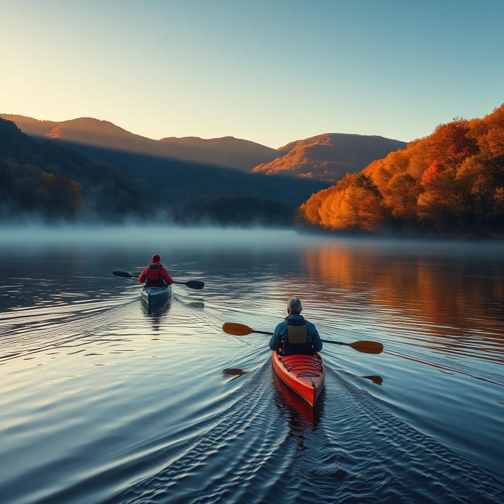
The Shenandoah Valley is quietly one of the best paddling regions in the Mid-Atlantic. The South Fork and North Fork of the Shenandoah River meander through farm country in long, lazy S-curves. The Maury cuts a limestone gorge south of Lexington. The upper James rolls out of the mountains with playful ledges. This guide walks you through where to put in, what water you'll actually paddle, and which outfitters can rent, shuttle, or guide you.
Know before you go
Valley rivers are gauge-dependent. Anything under 2.0 ft on the local USGS gauge is usually a bony scrape; 2.5–4.5 ft is the sweet spot for most float sections; above 5 ft, current picks up quickly and strainers become a real hazard. Always check the USGS gauge for your reach the morning of your trip.
- Wear a PFD — Virginia law requires one on board per person, and on the water for kids under 13.
- Summer weekdays are dramatically quieter than weekends on the popular South Fork sections.
- Sun exposure is the #1 issue on Valley floats — long-sleeve sun shirt, hat, and reef-safe sunscreen.
- Cell service is spotty in the river corridors. Tell someone your put-in, take-out, and ETA.
South Fork Shenandoah River (the easy classic)
The South Fork is the Valley's headline paddle — flat to gentle Class I with occasional Class I+ riffles, big scenic bends under Massanutten and the Blue Ridge, and a string of established public access points from Port Republic north to Front Royal. It's the right pick for families, first-timers, and casual float days with a cooler.
Best put-ins (south to north)
- Port Republic (Route 340 bridge) — top of the South Fork, quieter water, farm scenery.
- Elkton (Elkton Town Park) — mellow class I, good 6-mile float down to Shenandoah.
- Newport / Grove Hill (VDGIF access) — the classic 8-mile Luray float ends here.
- Bealer's Ferry / Massanutten Springs — mid-river access with the best Massanutten views.
- Bentonville Landing — most-used put-in in Warren County; big lot, easy launch.
- Karo Landing (Front Royal) — common take-out for multi-day trips ending in Front Royal.
Rapids and features to know
- Compton Rapid — the South Fork's most-named feature, a straightforward Class I+ wave train near Bentonville.
- Hazard Mill — small ledge/riffle downstream of Bentonville, easy to read and run.
- Foys Ford — shallow gravel-bar riffle, watch your line at low water.
North Fork Shenandoah River (quieter, more remote)
The North Fork winds through Shenandoah County from Broadway up past Mount Jackson, Edinburg, Woodstock, and Strasburg. It's shallower and more technical at low flows than the South Fork but far less crowded. Expect mostly Class I with a handful of Class I+/II riffles depending on gauge.
Best put-ins
- Meems Bottom (Route 720, near the covered bridge) — scenic launch with parking.
- Chapman Landing (Edinburg) — VDGIF access, common start for the Woodstock stretch.
- Woodstock (Route 758) — mid-river access, easy 6–8 mile float down toward Strasburg.
- Strasburg (Bowmans Crossing) — take-out or continue toward the Shenandoah River's confluence.
Maury River (whitewater near Lexington)
The Maury is a very different river — a narrower, faster limestone gorge with legit whitewater in the Goshen Pass section. This is the Valley's best-known intermediate paddle, but it demands whitewater experience, a proper boat, and a partner.
Goshen Pass (Class II–III+)
Six miles of continuous Class II–III with a few Class III+ features at higher water. Rolling required. The put-in is at the Route 39 Laurel Run bridge; take out at the lower Goshen Pass wayside. Optimal gauge is roughly 3.5–5.5 ft on the Rockbridge Baths USGS gauge. Not appropriate for open canoes or first-timers.
Lower Maury (Class I–II)
Below Rockbridge Baths, the Maury eases into a scenic Class I–II float down through Lexington and on to Buena Vista. Good option for advanced-beginner kayakers who want moving water without the pucker factor of Goshen.
Rentals and shuttles for the Maury and upper James are handled by Twin River Outfitters (Buena Vista) and James River Basin Canoe Livery (Lexington). Both run guided trips if you're new to the river.
Upper James River (ledges, smallmouth, and long floats)
The upper James forms at the confluence of the Jackson and Cowpasture rivers near Iron Gate and rolls east past Buchanan, Glasgow, and Lynchburg. Long stretches are big-water Class I with occasional Class II ledges — Balcony Falls being the headline feature — and the smallmouth bass fishing is famously good.
Signature runs
- Iron Gate to Eagle Rock — 10 miles, mostly Class I with a couple of Class I+ riffles.
- Glasgow to Snowden — includes Balcony Falls (Class II–III at typical flows), the most well-known rapid on the upper James.
- Snowden to Big Island — longer big-water float, great for a two-boat weekend.
Family-friendly flatwater alternatives
If moving water isn't your speed — or you're paddling with young kids — the Valley has a handful of lakes and impoundments perfect for a low-stress afternoon.
- Lake Shenandoah (Rockingham County) — 36-acre flatwater lake with an easy launch; electric motors only.
- Silver Lake (Dayton) — small, calm, walkable dam. A good first paddle with kids.
- Sherando Lake (Augusta County) — mountain lake in the George Washington National Forest with rental boats in season.
- Lake Arrowhead (Luray) — town-run lake with a public boat launch and picnic areas.
Multi-day and camping trips
The South Fork is the Valley's premier multi-day. A two- or three-day trip from Bentonville down to Front Royal is a Shenandoah rite of passage, with river camping at Shenandoah River State Park's canoe-in sites and multiple private campgrounds along the way. Book state-park canoe camps well in advance for summer weekends — they sell out.
Frequently asked
What's the easiest river to kayak in the Shenandoah Valley?
The South Fork of the Shenandoah River between Luray and Front Royal is the easiest and most popular paddle — mostly flat Class I water with a few gentle riffles and plenty of established put-ins and outfitters.
Are there any Class III rapids in the Shenandoah Valley?
Yes. The Goshen Pass section of the Maury River near Lexington has continuous Class II–III whitewater with a few Class III+ features at higher flows. It's the Valley's best-known intermediate whitewater run.
Do I need a permit to kayak the Shenandoah River?
No permit is required to paddle Virginia's Shenandoah River, but Virginia law requires a US Coast Guard-approved PFD on board for every person, and kids under 13 must wear one while underway.
Where can I rent a kayak in the Shenandoah Valley?
The main outfitters are Shenandoah River Outfitters (Luray), Down River Canoe Company and Front Royal Canoe Company (Bentonville/Front Royal), Shenandoah River State Park (rentals inside the park), and Twin River Outfitters and James River Basin Canoe Livery in the Lexington area for the Maury and upper James.
When is the best time of year to kayak in the Shenandoah Valley?
Late April through early October. Water is highest and most reliable in the spring, warmest for swimming in June–August, and quietest with beautiful foliage in late September and early October.
Is the Shenandoah River safe for beginners?
The South Fork and North Fork are generally beginner-friendly at normal flows (below about 4.5 ft on the local gauge). Always paddle with a partner, wear a PFD, and skip the trip if the river is high, muddy, or moving fast.